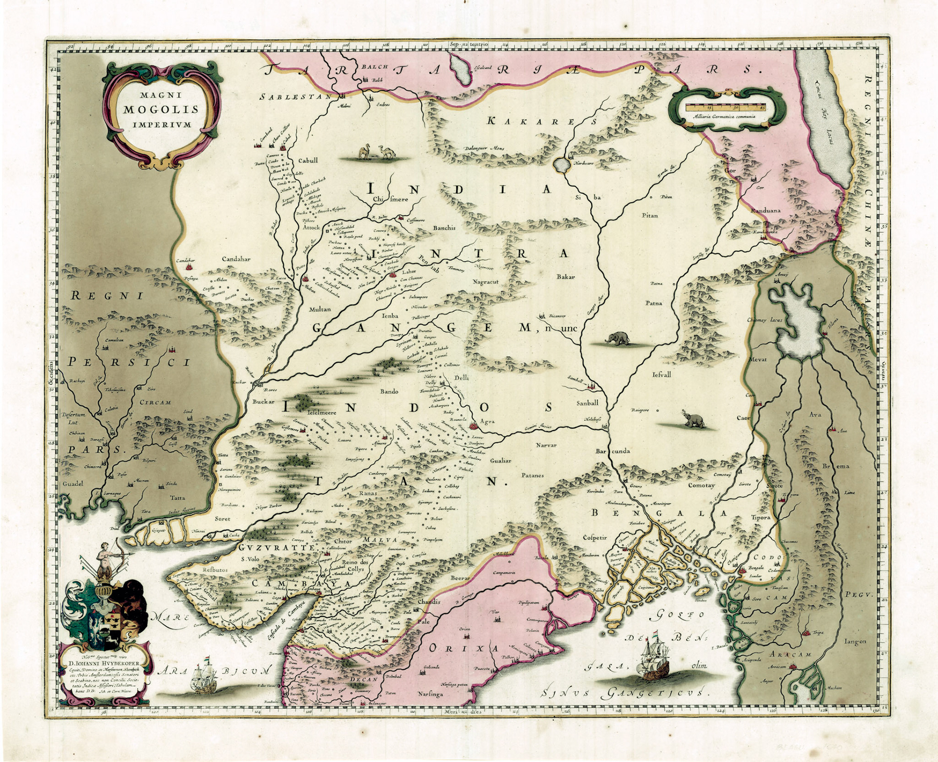
The Dutch cartographic tradition continued with Willem Janszoon Blaeu and his sons, Joan and Cornelis. Blaeu’s map of the Mughal Empire is not very different from that of Hondius. In fact when it comes to Bengal the maps are almost identical.
In this map Bengal is dominated by the Ganges River and its delta. There is another major river in the Bengal Basin further to the east known as the Brahmaputra River. Not a single European map of the 16th or 17th century identifies this river by its name. However in its general location there appears consistently a river called the Caor River.
The name of the Caor River first appears in Portuguese historian Joao de Barros’ classic work Decadas da Asia (c.1552). “The river of Caor”, de Barros narrates, “which traverses the kingdom so called (Gaur) and that of Comotay (Kamata), and that of Cirote (Sylhet), issues above Chatigao (Chittagong), in that notable arm of the Ganges which passes through the island of Sornagam (Sonargaon)”.
The Brahmaputra River originates near Mt Kailash in Tibet and flows eastward; it makes a hairpin turn to enter Arunachal Pradesh in India and flows west across Assam before entering Bangladesh. Here it splits into two channels. The Jamuna River, which is the major channel, flows south to join the Padma at Goalando and the “Old Brahmaputra” River, the minor channel flows southeast to join the Meghna River at Bhairab. At the time of this map the Old Brahmaputra River was the main channel.
The Old Brahmaputra must have been a formidable river. The Ain-i-Akbari (c.1590) or Institutes of Emperor Akbar while describing the Ganges River in Bengal mentions “There is another large river, called Berhumputter, which runs from Khatai (Cathay i.e. China) to Coach (Cooch Behar), and from thence through Bazoohah (large Mughal district including present Mymensingh and surrounding areas) to the sea”. The switch to the Jamuna channel happened sometime in late 18th/early 19th century. It is reasonable to assume that the Caor River of European maps are the same as the Old Brahmaputra river of Bengal.
The origin of the name Caor however remains a mystery. One possibility is that at some part of its course it may have been named after the long obliterated Gaur Kingdom of northern Sylhet. In this map the Caor River receives an unnamed tributary. This tributary passes by Sirote (Sylhet), and we can assume that this is the Surma-Meghna River.
The Caor River is shown arising out of a great lake to the northeast of Bengal called Chiamay Lacus (Lake Chiang Mai). This lake first appears in Giovanni Ramusio’s Terza Tavola shown in this website. This is a massive lake with several major rivers flowing out of it. The problem is there is actually no lake of this magnitude in this general area. Once this lake entered the cartographic record, subsequent cartographers kept on copying it into their maps without verification for over 200 years.