BENGALA
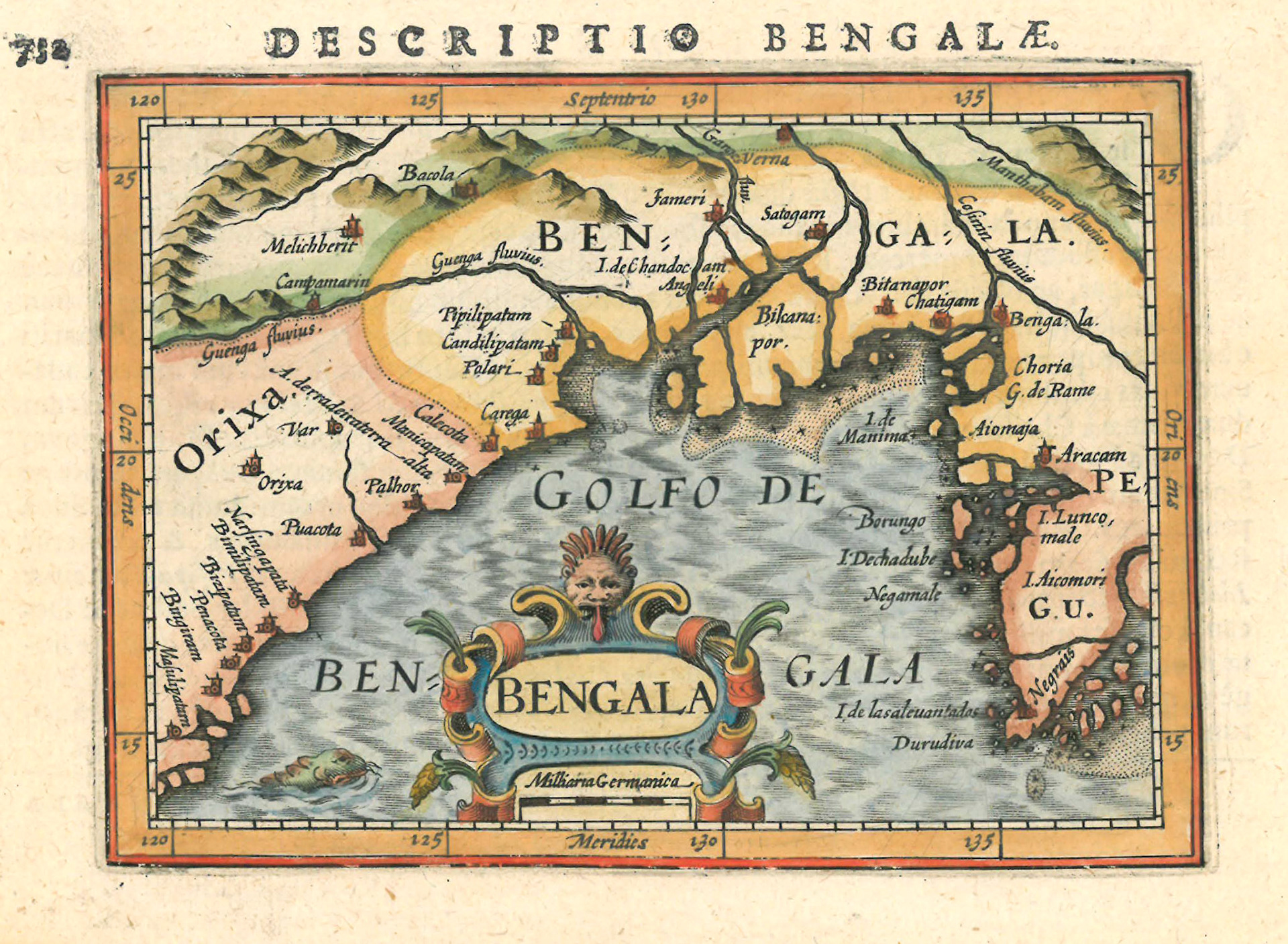
This elegant map is the first printed European map with Bengal as its title. It is taken from the miniature atlas “Tabularum Geographicarum Contractarum” by the Flemish cartographer Petrus Betrius. The earliest version of this map appears in 1598, in the atlas “Caert Thresoor” by Dutch cartographer Petrus Kaerius. The map is derived from The Itinerario by Jan Huyghen Van Linschoten.
The period of this map was a time of great political instability in Bengal. In 1574 Emperor Akbar’s Mughal forces had overthrown the last independent sultan of Bengal, Daud Khan Karrani, and crushed all opposition in western Bengal. Eastern Bengal however proved very difficult to dominate.In 1586, Ralph Fitch, an English merchant travelling in this region writes, “They be all hereabout Rebels against the King Zebaldin Echebar (Emperor Jalaluddin Akbar): for here are so many Rivers and Ilands, that they flee from one to the other, whereby his Horsemen cannot prevaile against them…”. The rebels here are led by a confederation of Bengali chieftains called the “Baro Bhuiyan”, whose efforts to challenge the far superior Mughal forces are the stuff of Bengali folklore.
In his annual report of the Jesuit Mission in Goa, dated December 1, 1600, Father Nicholas Pimenta mentions the Mughal assault against the resistant forces in eastern Bengal: “Twelve princes, however called Boyones (Bhuiyans) who governed twelve provinces in the late King’s ( Daud Karrani’s) name, escaped from this massacre. These united against the Mongols (Mughals), and hitherto, thanks to their alliance, each maintains himself in his dominions. Very rich and disposing of strong forces, they bear themselves as Kings, chiefly he of Siripur (Sripur), also called Cadaray (Kedar Rai) and he of Chandecan…”
A prominent area of this map is “I. de Chandecan”. The name is derived from a prior zamindar of this area named Chand Khan. The king of Chandecan mentioned in Pimenta’s report is none other than King Prtapaditya of Jessore. An aura of legend surrounds the personality and rule of this king. One of the most powerful of the Baro Bhuiyan, his territory included large tracts of Khulna and Barisal divisions in Bangladesh and extended into Nadiya and 24 Pargana districts in West Bengal.
Another area shown in this map, Bikanapur, is Bikrampur. An ancient political and cultutral center it is now part of Munshiganj district of Bangladesh. It was at this time known as Sripur and ruled by Kedar Rai, another member of the Baro Bhuiyan.
A considerable number of Portuguese men had settled in the coastal districts of Bengal including the areas mentioned above. They married local women and started small Christian communities. Some were mercenaries in the armies of Chandecan and Sripur. Others were involved in piracy and the slave trade. These members of the “Portuguese Shadow Empire” did not have any connection with the “Estado da India”, the administrative unit of the Portuguese Crown. They did however maintain contact with the Catholic Church.