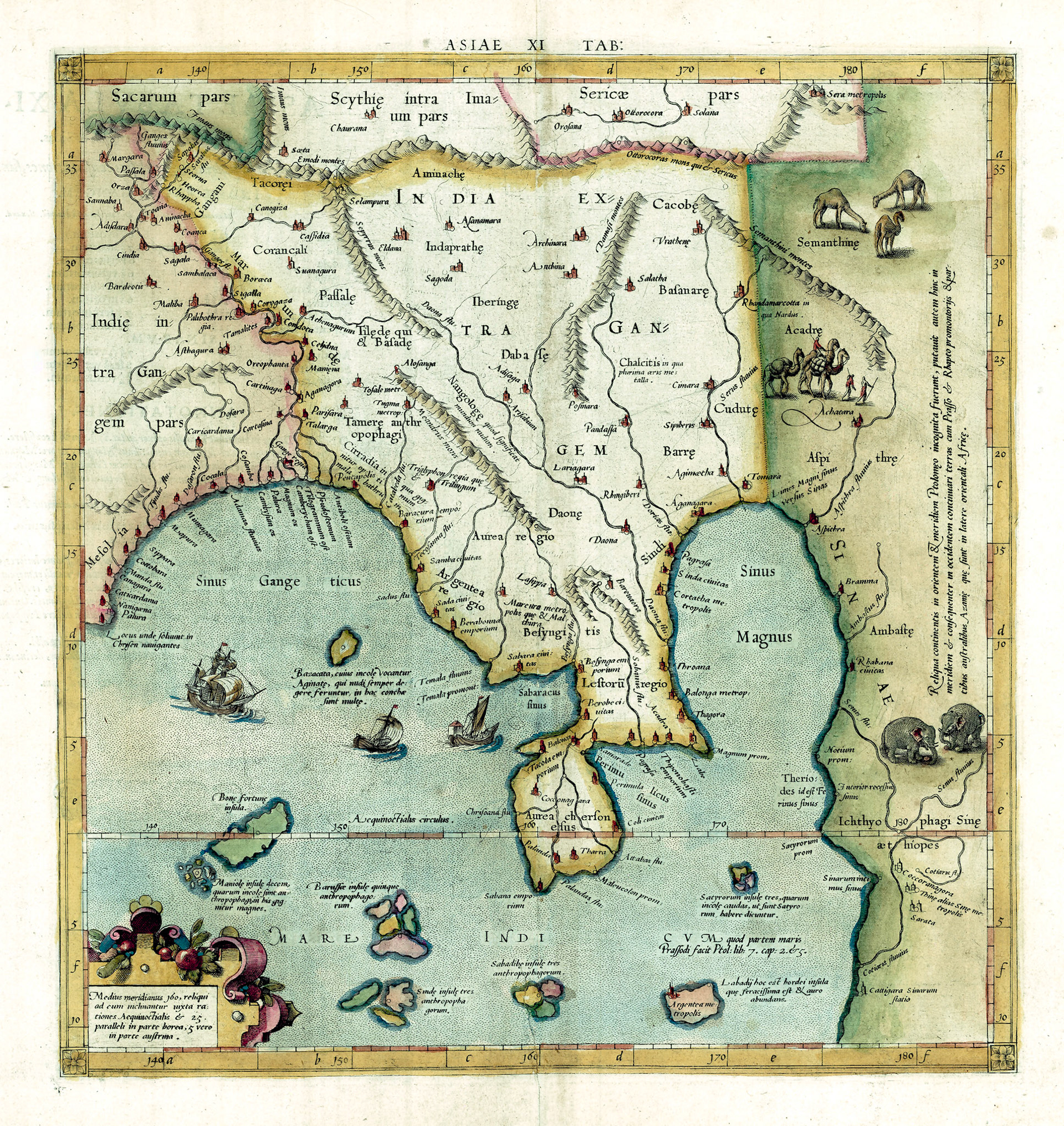
Bengal straddles the lower Ganges River. The eastern part of Bengal is included in Ptolemy’s eleventh map of Asia: India Extra Gangem or India outside (meaning the other side of) the Ganges. There is a string of cities on the east bank of the Ganges: Celydna, Aganagora, Talarga – none of which have been identified.On the coast the city of Pentapolis could be at or near Chittagong. The Catabeda River possibly the Karnaphuli River and Baracura Emporium is thought be the town of Ramu near Cox’s Bazar, Bangladesh.
There are archeological evidences of two major urban areas in Eastern Bengal that predates Ptolemy. One is the extensive fortified city of Mahasthangarh in Bogura District, Bangladesh; the other is the recently excavated Wari-Bateshwar fortified complex in Narsingdi District, Bangladesh. Ptolemy indicates two cities as “metropolis” in this general area: Tosale and Tugma. However there is no evidence linking them to the ancient ruins in Bangladesh. Archeologists working at Wari-Bateshwar site believe that this city is Ptolemy’s Suanagura which is placed further north in this map.
This map also includes several inscriptions taken directly from Ptolemy’s text. One states: “Cirrhadia, where the best Malabathrum is found”. “Kirata” is a general term that the Sanskritized Indo-Aryan people of the Ganges Valley used to refer to the Tibeto-Burman speaking people of the mountains to the north and west of Bengal. More specifically the “Rajmala”, the chronicles of the legendary kings of Tripura, mentions that the ancient name of Tripura Kingdom was Kirata-Desh. Malabathrum is the Indian Bay Leaf, also known as Tamalapatrum (Sanskrit) and Tejpata (Bengali) used as a spice in cooking. The bark of the tree was used for medicinal purposes and was obviously being exported to the Roman Empire.
The Tamere people are designated as “Anthropophagi” or cannibals. This may be a reference to the practice of headhunting. The Mizo and Naga people who live to the east of Bengal were known to be headhunters well into the 19th century.
Ptolemy’s text clearly states the routes taken by Roman merchant shops as they crossed the Bay of Bengal. From the city of Palura on the eastern coast of the Indian Peninsula they sailed directly east to Sada City on the Myanmar coast. This route entirely bypassed the Bengal coast and so any trade between Bengal and the Roman Empire at least in Ptolemy’s time would have been indirect.
This map was engraved by the famed Dutch cartographer Gerardus Mercator. This was the beginning of a golden period in Dutch cartography. As is apparent from the details and vignettes in the map cartography was being elevated into an art form.