In early European history “India” was more of a concept than a geographically defined place. The term was loosely applied as the “inhabited lands to the east of Europe” and sometimes meaning all of Asia. For Alexander the Great’s invading army, India was a more specific place. It was the land to the east of the Persian Empire across the Indus River, the furthest extent of which was unknown.
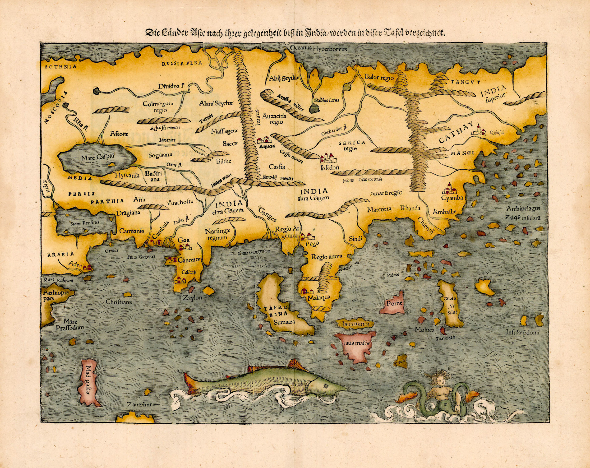
This map by the German cartographer Sebastian Munster is the first printed map of the Asian continent. First printed in 1540 CE, this map combines the information from Ptolemy and Marco Polo as well as the more recent expeditions of the Portuguese India Armadas and Ferdinand Magellan’s circumnavigation of the earth.
The Ganges River is shown with its delta and in Ptolemaic tradition it separates India citra Gagem (India this side of the Ganges) from India ultra Gagem (India on the far side of the Ganges). Four cities are shown in India, all on the western coast. Narsingae Regnum represents the Vijayanagar Empire. This name was given to this territory by the early Portuguese explorers for the then king Vira Narasimha Raya who was long dead by the time this map went into print. Myanmar is shown as Regio Argentea (Kingdom of Silver) and Thailand as Regio Aurea (Kingdom of Gold). The map also shows Pego (Bago, Myanmar) and the Portuguese controlled port of Malaqua (Malacca, Malaysia).
The outline of the Munster map of Asia is a significant improvement over the Waldseemuller/Fries map. There are several features of this map which are rather amusing: the two tailed mermaid in the Indian Ocean; the port of Sindi in the East Asian coast, hometown of Sinbad the Sailor is supposed to be in Sindh, Pakistan and finally in Eastern Siberia we find India Superior.