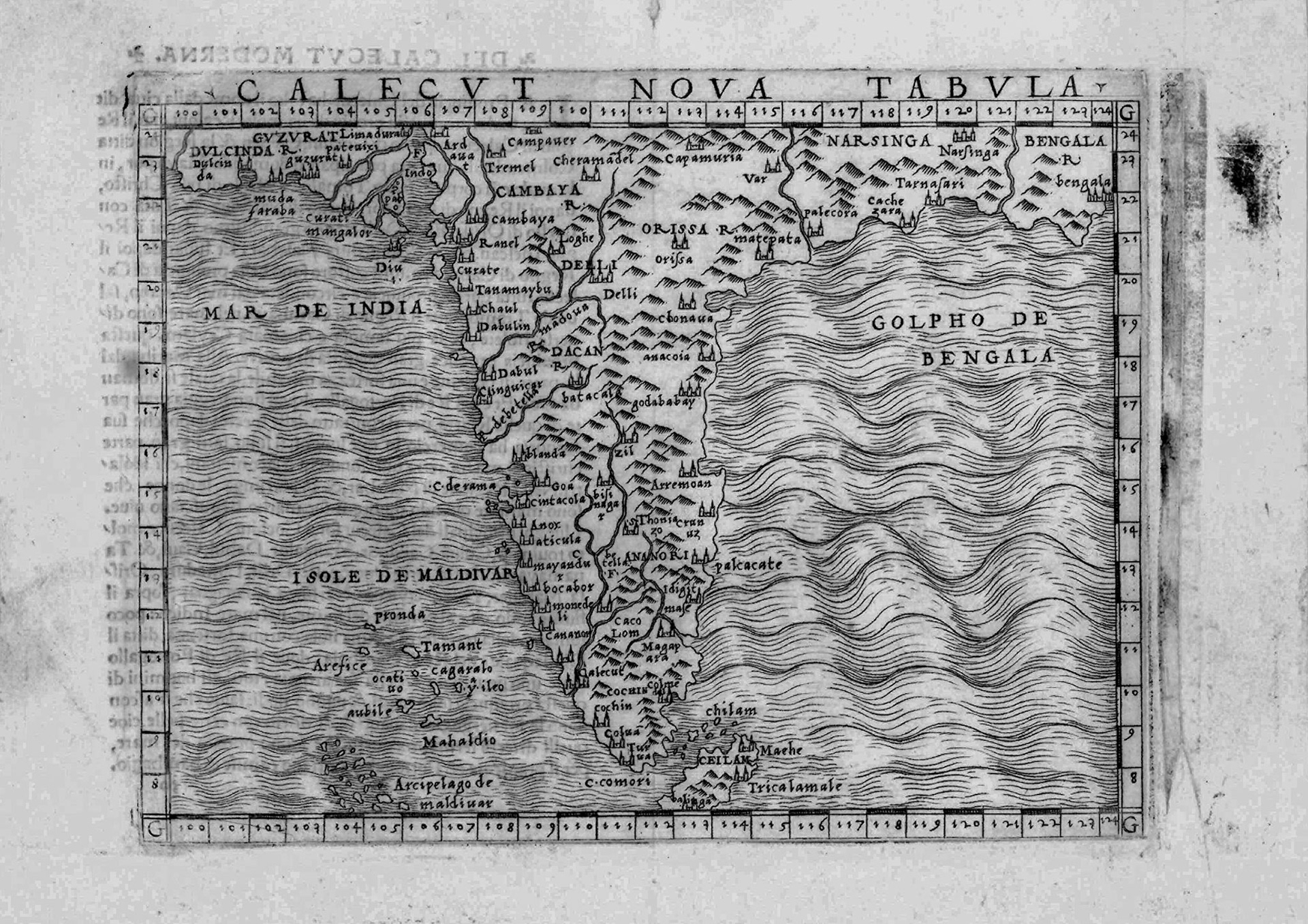
Giacomo Gastaldi’s “Calecut Nova Tabula” is the first printed map to focus on the Indian Subcontinent. A somewhat austere map, it contains significant information from early Portuguese explorations. Note that there is no mention of “India” in this map. The title of this map translates as “New Map of Calicut”. In the 1500’s the term “India” was used rather loosely in Europe, sometimes referring to the Indian Subcontinent, sometimes including SE Asia (the Indies) and sometimes applied to all of Asia. It was not until the 1700’s that European cartographers started using the term “India” specifically for the subcontinent. It was in Calicut (Kozhikode, Kerala) that Vasco da Gama first landed in 1498 in his quest for a direct sea route from Europe to India. It was also in Calicut that the first Portuguese trading post or factory was established. Gastaldi uses the title to emphasize that this is a map of India proper.
This map, from Gastaldi’s ‘pocket’ atlas of 1548, was the first printed map to show Bengal at its approximately correct location. An earlier map by Johannes Ruysch (1508) does show “Bangala”, but Ruysch places it on the Pacific coast of Asia, east of Tibet and south of the biblical lands of Gog and Magog!! https://upload.wikimedia.org/wikipedia/commons/4/47/Ruysch_map.jpg
Bengal in the north east of the map is shown as “Bengala R.” (Reino de Bengala or Kingdom of Bengal). Although the Ganges River is not shown, there is a coastal city named “Bengala” marked by a turret in the map. This city will continue to appear in European maps on and off for the next 200 years. The problem is that a city by this name does not appear in any Mughal or pre-Mughal records. The administrators of this period may not have had maps, but they kept detailed revenue records, many of which have survived. In none of these records, nor in the list of mint towns, which are towns of administrative or commercial importance, do we find a city named Bengala. The city is also not mentioned in the travelogues of Ibn Battuta (1346), Cesar Frederick (1570) or Ralph Fitch (1586), travellers who visited this area and left detailed records. The most likely explanation is that this city is Chittagong in Bangladesh.
There were two major trading ports for the Portuguese in Bengal. One was Satgaon in West Bengal the other Chatigaon (Chittagong) in Bangladesh. Because of the similarity of names the Portuguese called Satgaon as Porto Pequeno (Little Port) and Chittagong as Porto Grande (Big Port) or simply as Bengala. This alternate naming system led to some cartographic confusion where Chittagong was sometimes named as Chatigaon (or something similar) and sometimes as Bengala; some maps even showed them as separate adjacent cities.