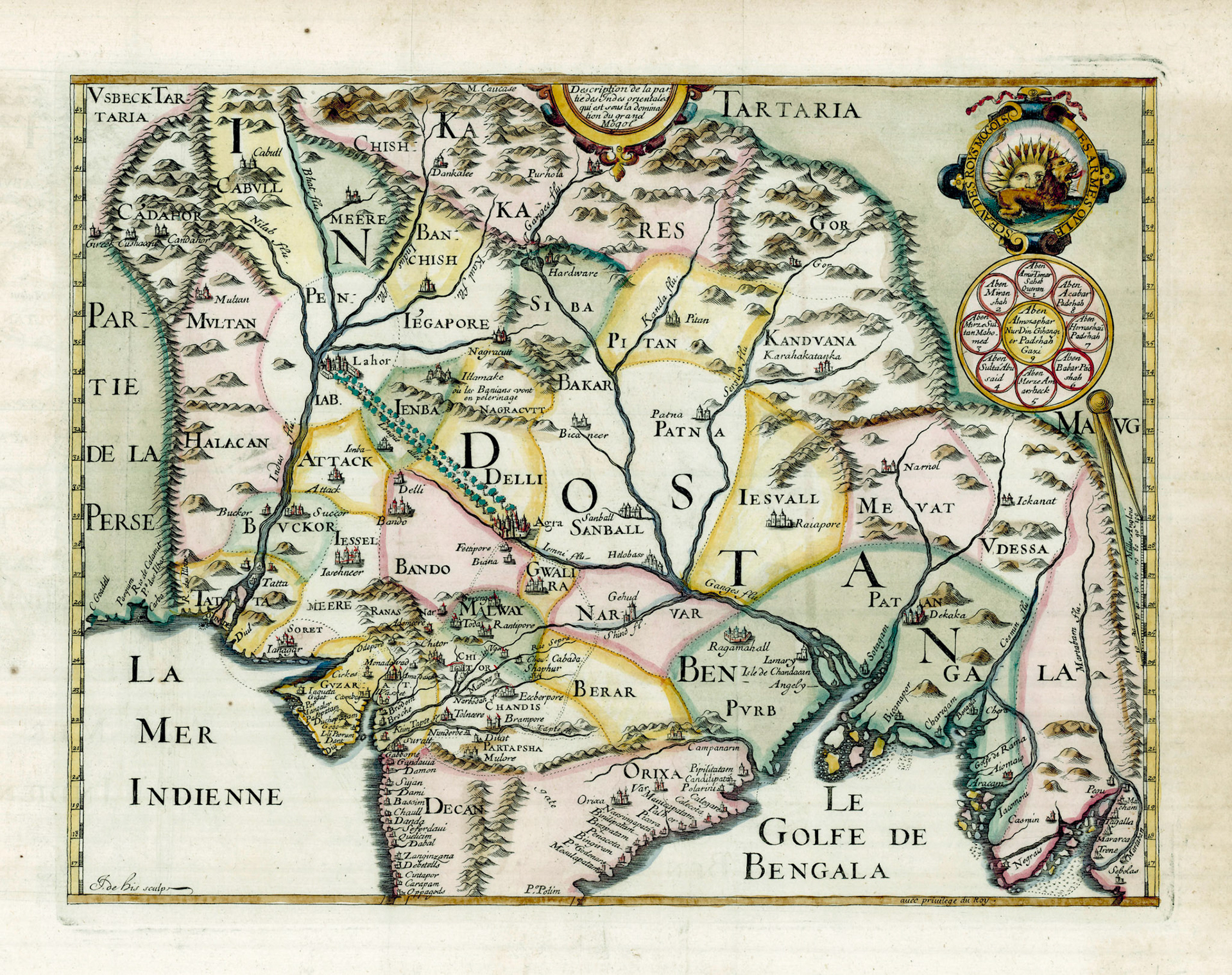
On February 17, 1619 Sir Thomas Roe boarded the Anne Royal at Surat, Gujrat. Roe was the first British Ambassador to the Mughal Empire, and had spent almost 4 years attached to the court of Emperor Jahangir. On board the ship he encountered the polar explorer William Baffin (after whom Baffin Island and Baffin Bay in Canada are named). Baffin was the master’s mate of the ship. Baffin was also a cartographer, and the collaboration between the two led to what is now called the Baffin-Roe map. A single copy of the 1619 printed map is now extant and is housed in the British Library. The map shown here is a later French version of the map.
"Bengala", writes Sir Thomas Roe, " A mightie Kingdome inclosing the west syd of the bay on the north and windeth southerly ... and the chiefe cities are Ragemehhell (Rajmahal) and Dekaka ( Dhaka). There are many Hauens as Port Grande (Chittagong), Port Pequina (Satgaon) traded by the Portugals ...It Conteyneth diuers Prouinces, as that of Purp and Patan".
Bengal is shown in this map as divided by the Ganges River into a western region of Purb and an eastern region of Patan. This division is not found in any Mughal record. The Sanskrit word for East is Purba, and Purb may have been an informal term for the easternmost province of the empire. Patan may be a reference to Pathans (Afghans), the overlords of Bengal who were defeated by the Mughal and then displaced to the eastern Bengal hinterland. Here the Afghans allied themselves with a loose confederation of local rulers called the Baro Bhuiyan (Confederation of the Twelve Lords) who resisted Mughal rule in Eastern Bengal for decades. In 1610 the Mughal governor of Bengal, Islam Khan Chisti moved the capital from Rajmahal to Dhakaand in a series of brilliant military maneuvers crushed the Baro Bhuiyan rebellion.
Sir Thomas Roe narrates in his journal: " The Severall Kingdomes and prouinces subject to the Great Mogoll Sha-Selim Gehangier (Jahangir) with the principall Cittyes and Riuers, the Scituation and borders, and extent in Length and Breadth, as neere as by description I could geather them. The names I tooke from the kings register"
The Mughal Emperor did not have a graphic map of his own territory. However the division of the Mughal Empire in the Baffin-Roe map is quite different from the fiscal divisions based on systematic surveys that we find in the Ain-e-Akbari, a detailed document recording the administration under Emperor Akbar from c.1590. Rather it looks like Thomas Roe’s list taken from the “Kings Register” was a historical list of kingdoms and territories which were incorporated into the rapidly expanding Mughal Empire, accompanied by their approximate geographical location. William Baffin’s work was challenging, in using the meager information given to construct a political map of the empire and errors were inevitable. The Padma, the main distributary of the Ganges is not shown at all and the Brahmaputra River is shown but not named.
The upper right hand corner of the map shows the Mughal imperial standard with its Lion and Sun motif. The Mughal were Persianized Turks and the motif has definite Persian roots. Below the standard is the genealogical lineage of Emperor Jahangir, with Temar (Tamerlane) at #1, Babar(6), Humayun(7), Akbar(8) and Jahangir(9) in the center.
A final note: The Tuzuk-i-Jahangiri is an autobiographical memoir of the first 19 years of Jahangir’s reign. This memoir goes into great details about the personalities he encountered in his reign. There is no mention of Sir Thomas Roe.