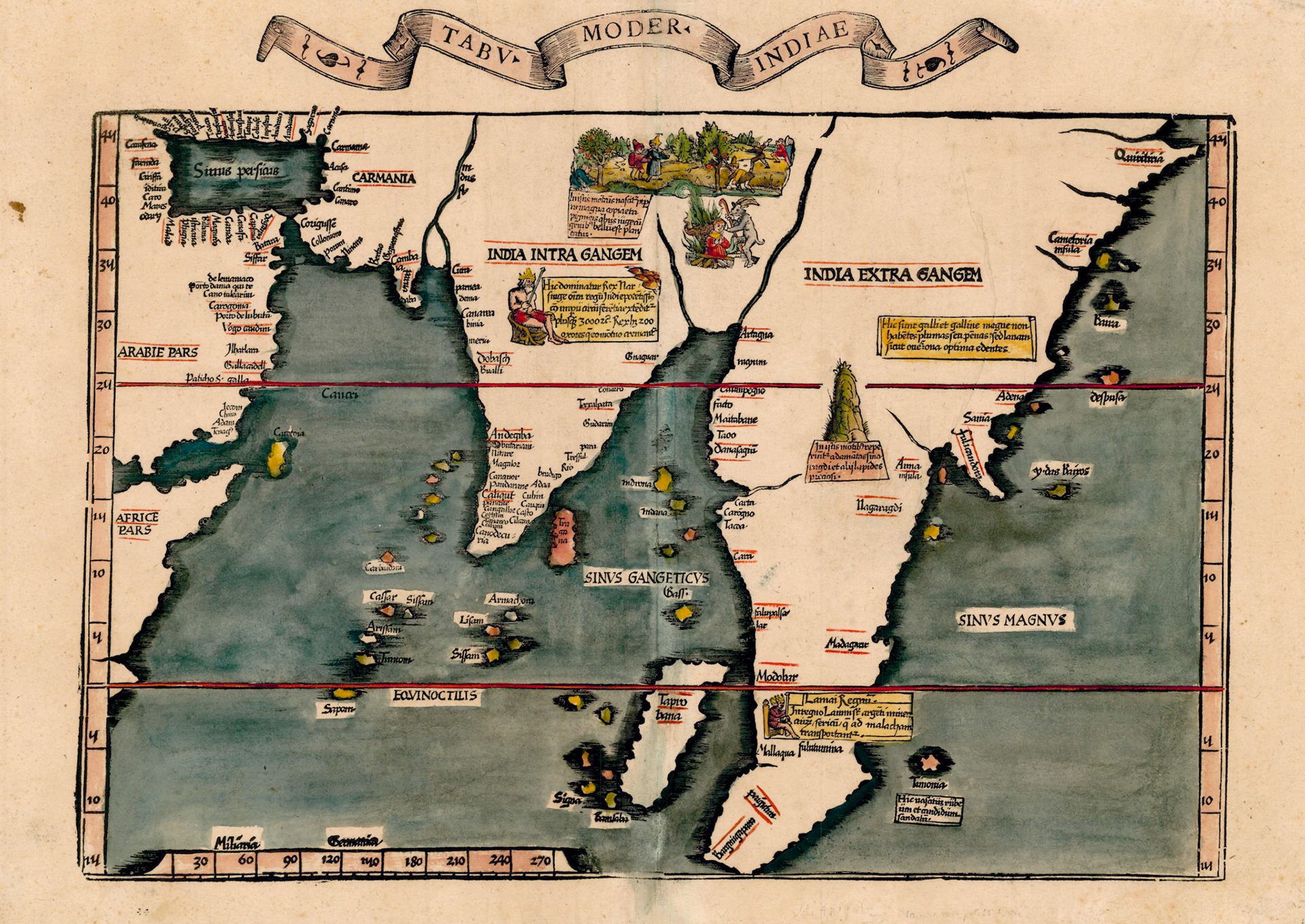
In the last years of the 15th century the discovery of the transatlantic route to the Americas and the sea route to India brought in a wealth of new geographic information to Europe. European cartographers started to incorporate this information to make so called “modern maps”. The German cartographer Martin Waldseemuller’s 1513 version of Ptolemy’s Geographia, in addition to having Ptolemaic maps, also had 20 such modern maps. The map showing India was called Tabula Moderna Indiae. The map shown here is a later version of this map by another German cartographer Lorenz Fries.
This map is strikingly different from Ptolemy’s Tabula Decima Asiae. The peninsular shape of India is recognizable. There are new place names on the coastal areas and the place names in the interior have disappeared. Recognizable names on the Malabar Coast of India are Cochim (Kochi), Cananor (Kannur), Caliqut (Kozhikode), Cangallor (Kodungallur) and Mangalor (Mangalore). In the Bengal area there are no place names but two rivers.
The geographic information in this map can be traced back to a manuscript world map called the Cantino Planisphere from 1502 CE, which is now housed in the Biblioteca Estense in Modena, Italy. In the 15th century the spice and luxury goods trade from Asia to Europe was a monopoly of the Venetian Republic. With the discovery of the sea route to India by Vasco da Gama this lucrative business was in jeopardy. The Venetians had their spies in Lisbon. Alberto Cantino was an agent of the Duke of Ferrara who smuggled this map from Portugal to Italy.
The Cantino map http://bibliotecaestense.beniculturali.it/info/img/geo/i-mo-beu-c.g.a.2.pdf shows two rivers flowing into the Bay of Bengal. The rivers are not named but at the mouth of the western river is the city of CATIGUAM (Satgaon, West Bengal) and at the mouth of the eastern river is CATIGAUN (Chittagong, Bangladesh). So the western river is the Hooghly branch of the Ganges and the eastern river is the Karnaphuli river.
The interior areas of the Fries map are relatively blank reflecting Portuguese interest in coastal trade. The cartographer has filled these spaces with vignettes that would have been on interest to European. One shows the ancient practice of “Sati”, where a widow immolates herself on the funeral pyre of her husband. A demonic goat with a staff adds a sinister European touch.