CARTE DE L'INDE DRESSEE POUR LA COMPAGNIE DES INDES
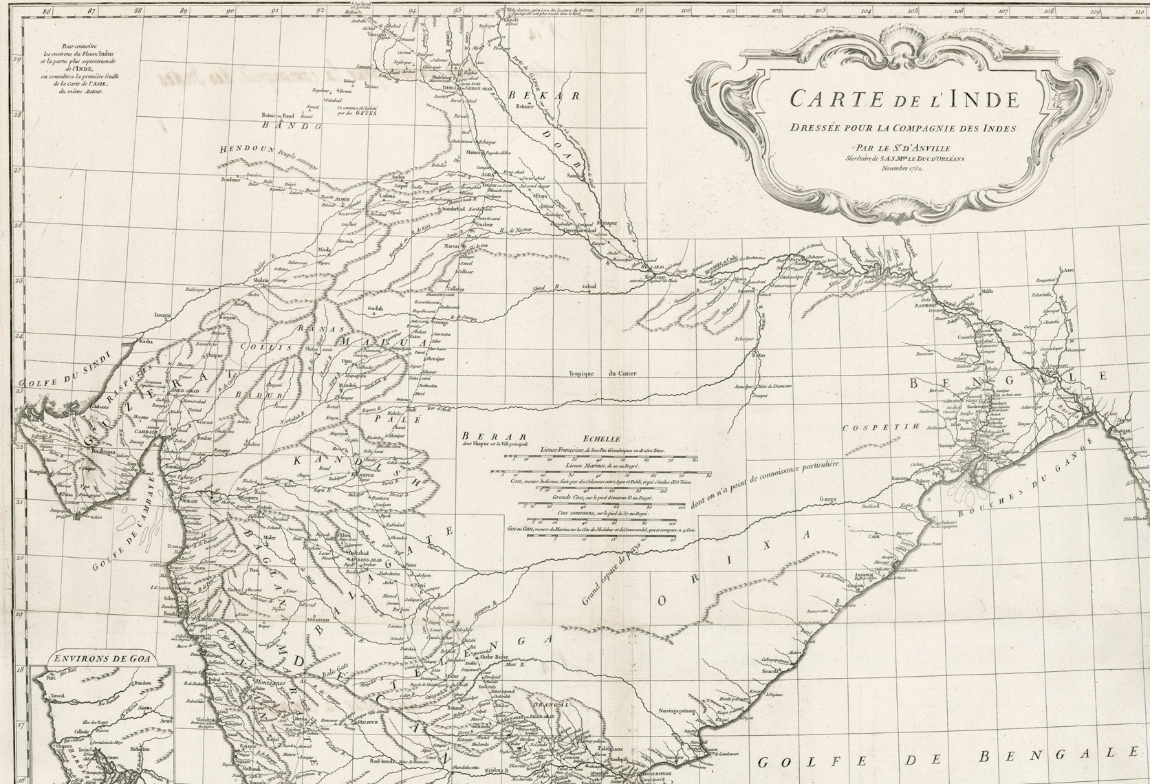
Jean Baptiste Bourgignon D’Anville was a French cartographer and geographer. He was active in the early and mid 1700’s. During this period he greatly elevated the standards of European mapmaking. Instead of copying older maps and adding new geographic information, he went back and did a rigorous analysis of the authenticity of the information on which those maps were based. The result was maps with less decorative elements and more geographic accuracy. The D’Anville map of India shows embarrassingly blank spaces, because he could not verify much of the information from previous maps. The section showing Bengal and the inset of the lower Hooghly River became standard maps of the region until Major James Rennell’s surveys for the British East India Company.
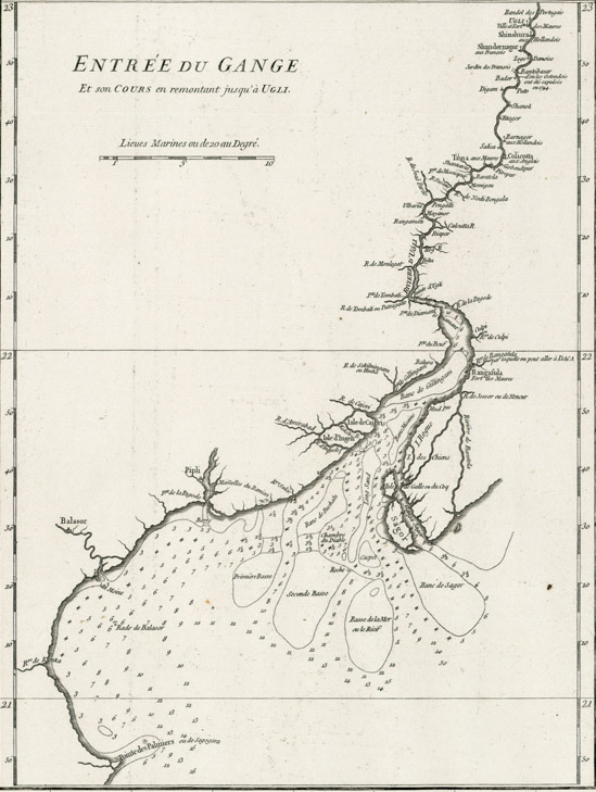
D’Anville’s attention to detail can be appreciated as he outlines the coordinates of the French settlement of Chandannagar : “…The latitude of Shandernagor, observed at the church in the fort, is 22o 51' 32”, and by a great number of observations to determine the longitude; father Boudier concludes its difference from Paris, 5 hours, 44 min. 25 sec. which gives 86o 5 or 6'. In the Philosophical Transactions of the Royal Society, for the year 1733, by an observation of an eclipse of the moon, on the 20th of December, 1732, O.S. M. Godin makes it 5 hours, 44 min. 37 sec. or 86o 9' ; and in a determination of longitude, the difference of a few minutes of a degree cannot easily be avoided.”
Here D’Anville describes the stretch of the Hooghly river between the city of Hugli and the English settlement of Calcutta: “Ugli is a ſortress of the Moors: By the word Moors here, I mean Mahometans, who govern the country, different from the natives or Indians. The latitude of Ugli, given by father Boudier, is 22o 56' North. This place being the most considerable in the country, the Europeans, who go up the Ganges, have given the lower part thereof the name of Ugli River, and the settlements built by them, to secure their trade, are situated along that river: That of the Portugueze, which they called Bandel, by adopting the Persian word Bender, which signifies a port, is now almost reduced to nothing, having been formerly very considerable, and is a little above Ugli. Just below Ugli is the Dutch settlement of Shinshura, next to that Shandernagor, a French settlement; then the Danish factory; and lower down, on the opposite shore, which is on the left hand going down, Bankibazar, where the Ostenders sometime had a factory and last of all Colicotta, belonging to the English, some leagues below Bankibazar, on the same side of the river.”
D’Anville describes a short cut to go to Dhaka from the mouth of the Hooghly River: “Lower down, on the left hand, near a Moor's fortress called Rangasula, the Ganges (Hooghly R) opens a channel which communicates with others, coming from the branch which passes by Daka”. And Dhaka is described as: “Daka is a great scrambling town, the houses whereof are mostly mean huts, built in a few hours time, by setting up stakes in the ground, and fixing hurdles thereto which serve for both walls and roof ; yet its trade, and the easy access to it on all sides by rivers, make it a considerable place. A little below Daka, the Ganges is joined by a great river, which comes from the frontiers of Tibet : The name of Bramanpoutre, which we find affixed to it in some maps is a corruption of that of Brahmaputren, which in the language of the country signifies, taking its rise from Brahma”