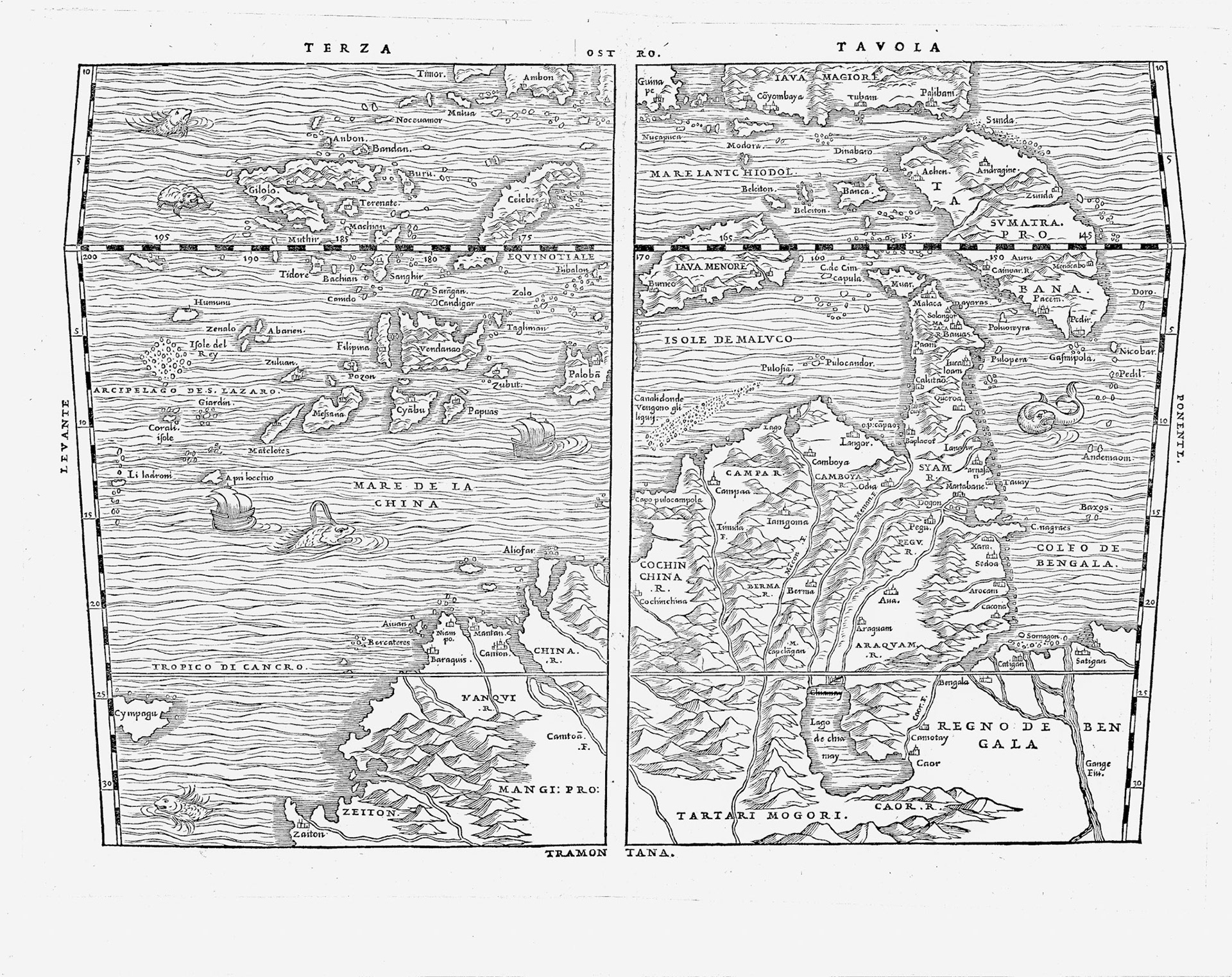
Giovanni Ramusio’s Terza Tavola depicts Southeast Asia as it was understood by Europeans in the middle of the 16th century. This is a south oriented map, so south is up. Ramusio was secretary of the powerful Consiglio dei Dieci (Council of Ten) of the Republic of Venice. In his position he had access to the explosion of new information coming in from explorers, mariners and travelers returning to Europe from around the world. A geographer, travel writer and linguist, he compiled these into his seminal work Delle Navigationi et Viaggi.
In the history of cartography the Terza Tavola is a formative map of SE Asia, it is also an important early map of Bengal. For the first time we see several cities in the interior of Bengal. The information about Bengal for this map is based on Portuguese historian Joao de Barros’ classic work Decadas da Asia (c.1552). “The river of Caor”, de Barros narrates, “which traverses the kingdom so called (Gaur) and that of Comotay (Kamata), and that of Cirote (Sylhet), issues above Chatigao (Chittagong), in that notable arm of the Ganges which passes through the island of Sornagam (Sonargaon)”.
The Caor River is a proxy for the Brahmaputra River. “Caor” does not have any equivalent in any of the regional languages and dialects. Kamata and Gaur (not to be confused with Gaur, the medieval capital of Bengal in Maldah district of West Bengal), were medieval kingdoms to the north of Bengal. Gaur Kingdom included parts of Sylhet and Kamata Kingdom included northwest Bangladesh and adjacent areas of West Bengal. Both kingdoms had collapsed at the time this map was printed but the regional names may have persisted among the people. Sonargaon, an important inland port, administrative center and a onetime capital of the Bengal Sultanate is not an island!
In the section where Ramusio summarizes the kingdoms, cities and people of the East Indies, he states: “Of the ports of this kingdom (Bengal), the principal is the city of Bengala, from which the kingdom takes its name. It takes two days from the mouth of the Ganges (Hooghly) up to this city … the Ganges River is greater than any other river of India and its people say that its water descends from heaven”. The city of Bengala referred to here is actually the city of Chittagong in Bangladesh. Here we see the confusion created by Portuguese sailors in the dual use of Chatigao and Bengala for the port of Chittagong.
The Caor River is seen originating from Lake Chiamay. This is a fictitious lake, to be discussed in a later section